Monitoring of Antarctic Sea Ice during IPY
Welcome to our ISSI project website.
The following ESA IPY AOs are joined in this ISSI project:
• Sea-ice motion, deformation, thickness and lead dynamics in the Antarctic
(AO4007, PI: Haas)
• Southern Ocean sea-ice cover: kinematics, thickness, polynyas, and export
(AO4046, PI: Kwok)
• Complete mapping of Antarctic sea-ice dynamics and thickness
(AO4114, PI: Heil)
• Mapping and Monitoring of Circum-Antarctic fast ice.
(AO4123, PI: Massom)
Knowledge of the ice kinematics, ice thickness and their spatio-temporal variability is fundamental to evaluate the state of sea ice within the global climate system. Sea-ice motion and deformation as well as sea-ice thickness quickly respond to environmental changes. Hence, information on their baseline and variability is crucial to assess the climate system.
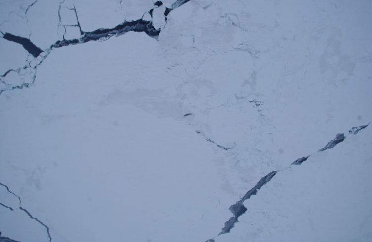
SAR imagery has provided regular information on the ice drift and deformation at high spatial resolution over large regions. Our ISSI activities have focussed on the Antarctic ice zone, a previously sparsely sampled region (i.e. by RADARSAT). Two of the linked proposals (ESA AO4114 and ESA AO4123) were aimed to provide baseline snap-shots of circum Antarctic sea-ice properties including ice motion, deformation and thickness (for the pack ice and the fast ice, respectively; with ice-thickness information to be derived from coincident ICESat laser altimetry) during three important stages of the seasonal ice evolution: February (minimum extent while capturing perennial ice regions), June (early winter) and October (maximum ice extent). SAR imagery collected as part of ESA project AO4007 has provided a regional extension to in-situ sea-ice drift, deformation and growth measurements obtained during three Antarctic cruises (two during austral spring 2007, one during austral autumn 2008) and from drifting sea-ice buoys. The satellite data analysis has made a significant contribution to the overall success of these field campaigns. In addition, a ESA project AO4046 addresses high-frequency (sub-daily), high-resolution processes in the Antarctic sea-ice zone, knowledge of which is crucial to derive an estimate of open water within the pack (i.e. cracks or polynyas). The latter, in turn, is crucial to accurately estimate the net regional ice production, which itself is an important parameter within the polar climate system.
ISSI has presented an opportunity to join these four ESA International Polar
Year investigations and provided a springboard for continuing collaborations,
including linkging our sea-ice research with the work of operational sea-ice
groups, such as the Antarctic Polarview
node or GlobIce.
As part of our ISSI activity we have undertaken - at the data
level - to streamline data processing procedures as well as posting of
derived sea-ice parameters. Together these four ESA IPY projects cover nearly
the full range of state variables of Antarctic sea ice. The interpretation of
data from each ESA IPY project has benefit significantly from bringing together
all ESA IPY projects on Antarctic sea ice. A new analysis and display system
for overlapping ASAR imagery and joint analysis methods have been derived as
part of the ISSI workshop. For further details on closely related or derived
scientific, refer please to our publications page.
Team members on our ISSI projects are:
- Andreas Cziferszky • British Antarctic Survey, UK
- Geiger, Cathy • University of Delaware, USA
- Haas, Christian • University of Alberta, Canada
- Heil, Petra (ISSI Team Leader) • AAD & ACE CRC, Australia
- Hutchings, Jennifer • IARC/University of Alaska, USA
- Leonard, Katie • Institute for Snow and Avalanche Research, Switzerland
- Kern, Stefan • Institute for Marine Science, Germany
- Kwok, Ron • JPL, USA
- Maksym, Edward • BAS, UK (now WHOI, USA)
- Martin, Seelye • University of Washington, USA
- Massom, Robert • AAD & ACE CRC, Australia
- Saldo, Roberto • Dansk Technical University, Denmark
- Toyota, Takenobu • Hokkaido University, Japan
The following young scientists attended one or more of our meetings:
- Krutzky, Sandra • AWI & University of Bremen, Germany
- Ozsoy-Cicec, Burku • University of Texas, USA
- Rogers, Steven • University of Tasmania, Australia
- Selyuzhenok, Lera • AWI & University of Bremen, Germany
- Ernesto Trujillo-Gomez • Swiss Federal Institute for Forest, Snow and Landscape - WSL, Switzerland)
A number of publications have benefited from our team work.
MEETINGS held at ISSI:
A number of workshops of our ISSI team (2007-2009 & 2010-2012) were held at ISSI. The purpose of these meetings was to bring together scientists, data and analysis methods of individual research projects using SAR data to study Antarctic sea ice.
Agenda for the first meeting: 30 June to 03 July 2008
Agenda for the second meeting: 07 - 11 June 2010
Agenda for the third meeting: 29 May to 01 June 2012