|
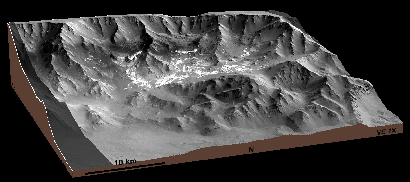
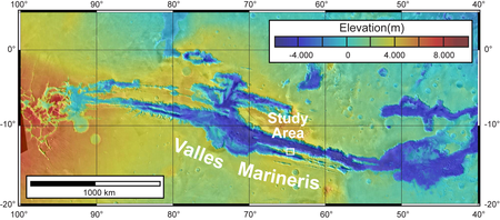
Located on the flank of the Tharsis region, Valles Marineris is a 4000 km long linked system of troughs. Coprates Chasma is one of the canyons of the Valles Marineris system, which is thought to have formed by faulting during extension. Located along the southern boundary of Coprates area is and area of interest because it contains several ILDs.
The southern boundary of the study area is formed by a
plateau ridge with an elevation of approximately 3700m. Located
approximately 25km north of the plateau ridge is a lower ridge of wall
rocks, which decreases in elevation from approximately -700 m in the
west to -3200 m in the east. Only at the western end is this ridge
connected to the southern plateau by a series of wall-rock
outcroppings. Wall-rock geometry has thus created a basin-like
structure with maximum dimension of about 40 km by 25 km. The flat
floor of this basin slopes from west to east, descending from an
elevation of approximately -1300 m to -3000 m. At the eastern end, a
gap in the northern wall rock ridge forms the geometry of an outlet to
the basin into Coprates Chasma proper, which has elevations of
approximately -5500m.
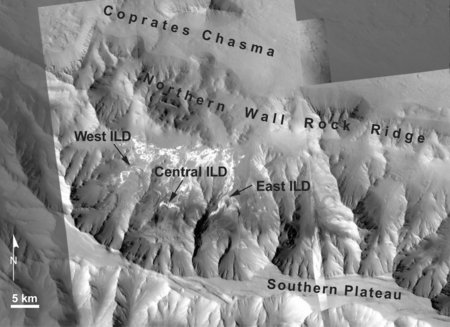
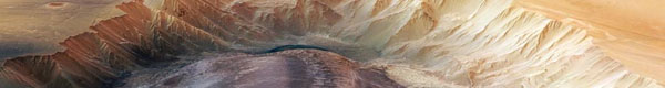
Located near the southern wall are three prominent
ILDs (here designated East, Central and West). Each is loosely
confined between two wall rock spurs; none extend significantly beyond
the extents of their confining spurs. In each deposit, the northern
erosional edge displays well defined layering. Their presumed contact
with the southern wall rock is covered by surficial deposits. Overall,
layering in each deposit dips gently toward the north. The deposits
are also associated with sulfates.

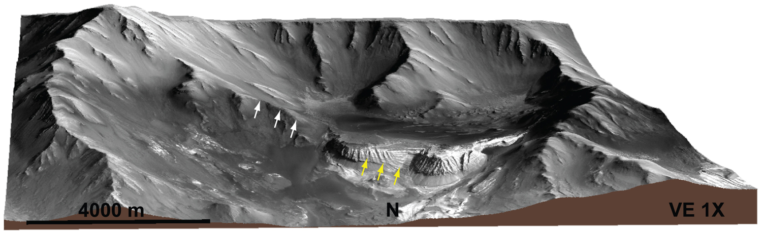
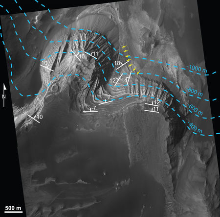
The deposit with the largest relief is the East IlD
which is nestled between two wall rock ridges. The layers at the base
of the deposit (yellow arrows) appear to follow the slope of the
adjacent older wall rock (white arrows). This indicates to us that
the deposit is older than the wall rock and that the material making
up the deposit was laid down on pre-existing wall rock.

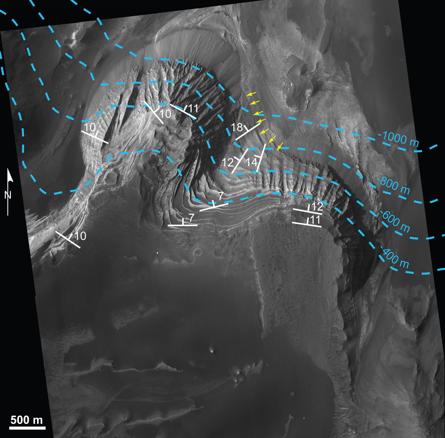
At the northern edge of the deposit, the thickness of
the layered material is more than 600m (the blue lines represent
elevation contours). We are able to measure the three dimensional
orientations of the layers (white symbols) and find that they become
shallower near the top of the deposit. This is what would be expected
if a sedimentary deposit gradually fills a sloping floor. Near the
base of the deposit layers will follow the slope of the substrate, as
the sedimentary package gets thicker, the layers become more
horizontal.
In 3D the layering is clearly visible.
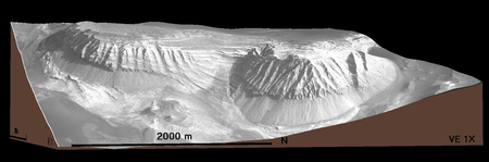
This deposit as well as the two adjacent ones is currently the focus
of a study that aims to understand their formation and subsequent
history. Placing constraints on the geological history of deposits
such as these will provide some insights into the history of Mars as a
whole.
|