When the International Space Science Institute (ISSI) hosted its very first workshop in 1995, cross-disciplinary international collaboration was far less commonplace. Yet, heliospheric science was already thriving, and among the participants was a young scientist named Eberhard Möbius. Nearly three decades later, as ISSI hosts the workshop “Multi-Spacecraft Observations and their Importance for Understanding Particle Dynamics in the Inner Heliosphere”, Möbius is back — this time alongside Dr Emma Davies, a first-time ISSI participant representing the next generation of space scientists.
Their shared presence offers a natural bridge between the past and the future of space science. It is a living example of how careers, ideas, and collaborations evolve shaped by the ISSI ecosystem.
A diverse group of scientists has gathered at ISSI for the workshop “Opening up Earth Observations for Climate Adaptation”, convened by the My Climate Risk Lighthouse Activity of the World Climate Research Programme (WCRP).
The meeting brings together satellite remote-sensing experts, climate scientists, modellers, social scientists, philosophers, and data practitioners from across the globe. Participants span a wide range of scientific backgrounds and career stages, working on global, regional and local climate impacts, inclusivity, and shaping the global Earth observation (EO) landscape. Their geographic diversity is equally notable, with contributors from Europe, Africa, Asia, the Americas, and the Pacific, reflecting the truly global nature of the challenge.
What have White Dwarfs, Neutron Stars, and Black Holes in common? – Accretion disks! For a Swiss who has stirred cheese in multiple occasions and settings, a direct comparison to fork-induced cheese swirls seems obvious. As Alexandra Veledina from University of Turku in Finland points out, the spinning matter of the two might look similar but the physics involved are fundamentally different. Veledina was one of the lead conveners of the ISSI Workshop on Accretion Disks bringing together more than thirty international experts to discuss and sharpen our understanding about them that we developed over the past fifty years.
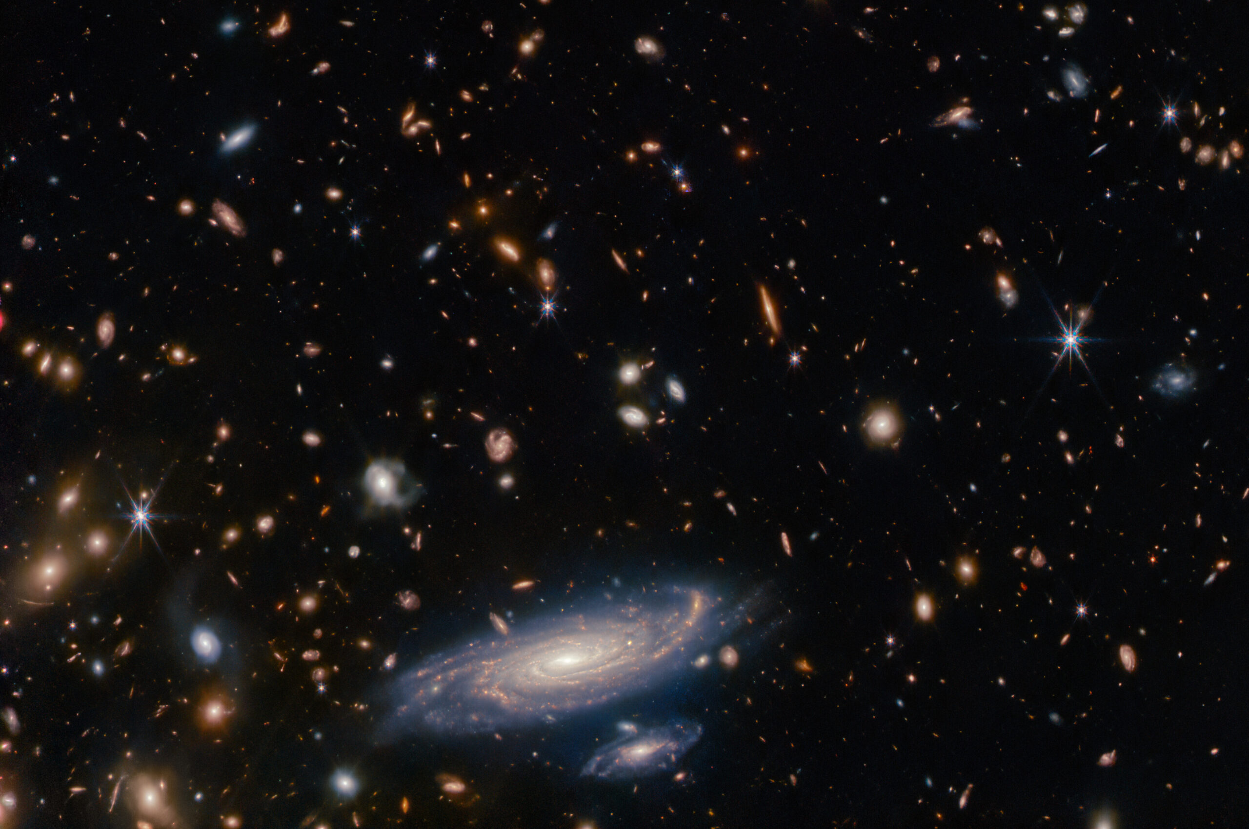
ISSI is currently witnessing a vibrant exchange of ideas as experts from across the globe are convening for the inaugural day of the “Chronology of the Very Early Universe According to JWST: The First Billion Years” workshop.
The dynamic connections between space weather and weather in Earth’s lower atmosphere was the target of last week’s ISSI workshop. This gathering, between leading experts in space, Earth observation and atmospheric science, delved into the intricate physical interplay shaping our planet’s weather and climate.
This workshop will focus on the economics and governance of commercialisation in outer space. It will look at the applicability of economic concepts, the concepts of international economic law, and the concepts of economic governance to space-based commerce.
The observation by NASA’s Parker Solar Probe mission of very strong magnetic field fluctuations in the inner heliosphere, leading to strong deflections locally reversing the direction of the field itself, called switchbacks, has attracted considerable attention from the heliophysics and space physics communities.